Overview
Catmosphere is a forward-thinking initiative dedicated to enhancing the understanding of natural disasters. Its mission is to provide access to anyone, no matter their personal knowledge, to a global overview of the past, ongoing and future extreme events, bridging the gap between complex data and public understanding . This multi-phase project begins with Open-Source models and will incorporate more sophisticated methodologies.
Who am I?
My name is Mathys Baldacchino, I am a 26-year-old professional from France, with a deeply rooted passion for mathematics, particularly in its application to nature. Following my master’s degree in actuarial science, I have spent the past 4 years in reinsurance (insurance for insurers against major events) as an Analyst, Catastrophe Modeler and ultimately Director of Research & Development. Projects have always been important to me, contributing to advance human knowledge and fostering greater understanding. Catmosphere is the one that stands out as the initiative I am most passionate about, as it holds the potential to significantly impact the future.
Description
The project will initially consist of a website featuring an interactive map providing updates on ongoing natural events. In addition, dedicated sections will offer insights into past occurrences and projections for the future. Each type of peril would be presented alongside the relevant available research and used for the provided tools.
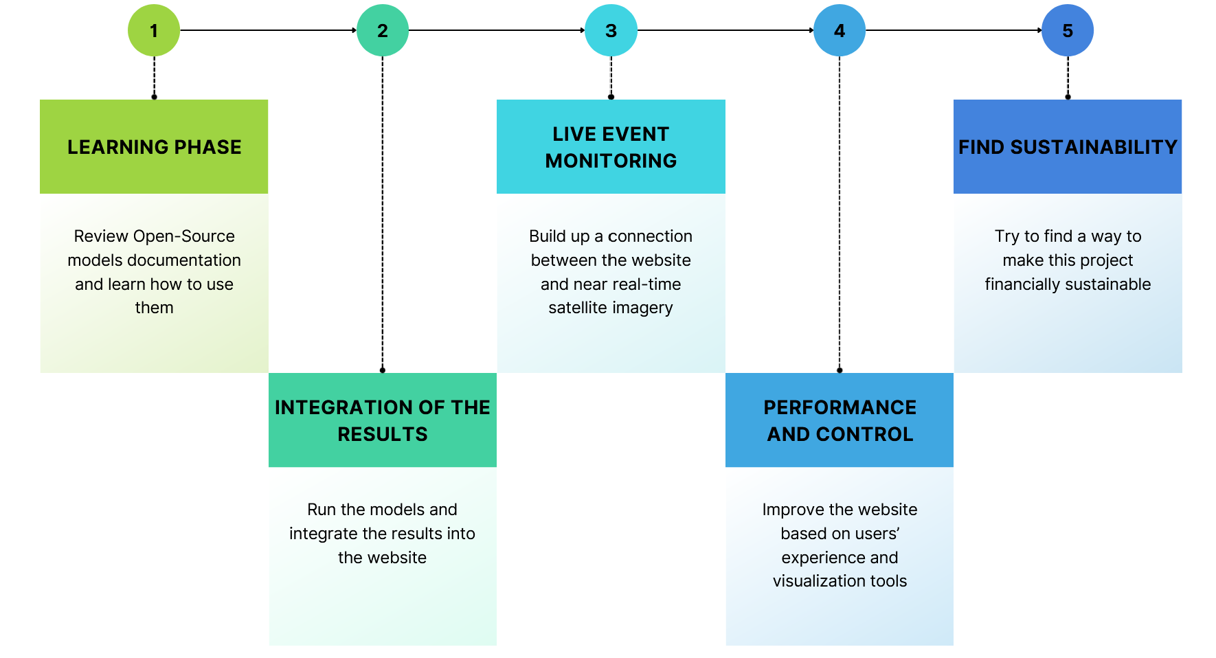
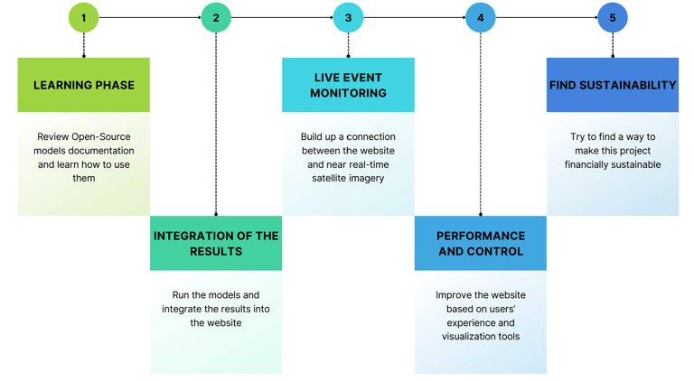
Given the vast scope of natural disaster modeling, the initial phase will focus on a more constrained region and set of perils. Europe will be studied primarily, with a focus on Extratropical windstorms (commonly referred to as winter storms), Convective storms (hail mainly in Europe), Floods and Earthquakes. There is extensive research conducted in these fields, on which this project will benefit from. Open-Source models such as WRF, ICON, and OpenQuake will be the foundation of the project’s initial phase, with their documentation reviewed, and simulations presented for the forecasts. Live events monitoring will rely on publicly available satellite imagery from sources such as NASA overview, Spectator Earth and EOSDA LandViewer. For historical data, ERA5 reanalysis datasets will be used for atmospheric events while EMSC datasets will be used for earthquakes. Establishing this foundational framework is a crucial first step, ensuring that the project is built on robust scientific methodologies and scalable infrastructure for future expansion.
Motivation
Over time, I have observed a growing disconnection between public understanding of global events and the narratives related by traditional media. The increasing complexity of applied mathematics in practical applications has further exacerbated this gap. It is therefore crucial to build bridges between scientific research and public awareness. While all eyes are on climate change and natural disasters, it is difficult to have a clear and comprehensive overview due to fragmented and sometimes conflicting sources of information.